2010 Mentawai Islands Tsunami
Introduction
At 21:42 on October 25, 2010 (local time, UTC+7), an earthquake of Mw 7.8 took place near the Mentawai islands in Indonesia, which generated a large tsunami. The large tsunami struck the coastal area of North Pagai, South Pagai, and Sipora islands.
Field Survey
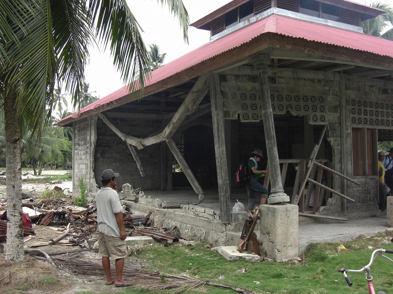
The field survey was conducted on the south part of Sipora island from November 19 to 20, 2010. Our survey team consisted of members from Waseda University, Yokohama National University, and Bandung Institute of Technology. During the survey, four villages (Bosua, Old-Gobik, MAsokut, and Bere-Berilou) in Sipora island were surveyed.
- Bosua: The tsunami reached around 300 minland, propagating along a road that started from the coast and ran inland. An inundation height of 4.81 m measured near the shoreline was the largest recorded for this village, gradually decreasing as the wave travelled inland, and the run-up height was 2.55 m. People evacuated from the coastal area when the tsunami arrived, and thus no casualties were reported.
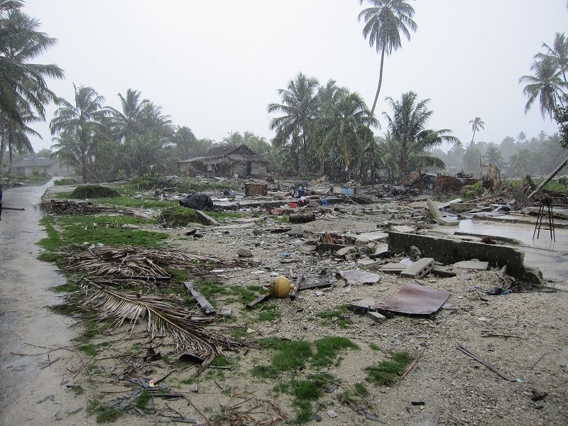
- Old-Gobik: An inundation height of 5.69 m was measured in the swamp area, and inundation heights of 2.5-3.5 m were recorded inside the residential area. Almost all houses were washed away, leaving only their foundations behind. Due to the serious damage caused by the tsunami, residents decided to relocate to higher ground (which is why the place is called “Old-Gobik”) and start a new village (“New- Gobik”) to the east side of the former village.
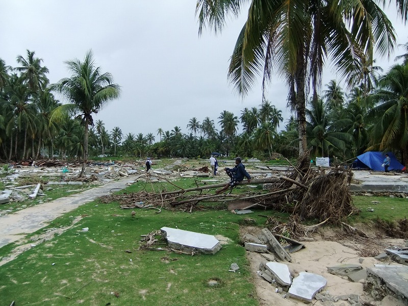
- Masokut: Eight people lost their lives in this village. A river ran through the north side of the village, while a sand dune protected its shoreline (the height of the top of the sand dune was around +1.5 m from the sea level at the time of the tsunami arrival). Inundation heights were measured at six points in this village: 4.42, 5.67, and 6.96 m in the north side, 2.43 m in the middle of the village, and 3.43 and 5.01 m in the south side.
- Bere-Berilou: The inundation heights measured in this village were relatively small in comparison with those measured in the other three villages. However, five people lost their lives. Though there was a road which could help people move inland from the coastal areas, there was no higher ground or a tall building located close to the shoreline.
References
- Mikami, T., Shibayama, T., Esteban, M., Ohira, K., Sasaki, J., Suzuki, T., Achiari, H. & Widodo, T. (2013): Tsunami vulnerability evaluation in the Mentawai islands based on the field survey of the 2010 tsunami, Natural Hazards, 71(1), 851-870. [doi:10.1007/s11069-013-0936-z]